3D-photogrammetry is a key tool in geological mapping. In West Greenland more than 2000 meters high mountains were exhumed during the Neogene due to the post-glacial uplift and cut by deep fjord systems. The steep cliffs and the Km-scale continuous outcrops represent a natural laboratory for structural geology and geological mapping of Palaeoproterozoic metamorphic rocks.
Geological Mapping 1:100 000 scale
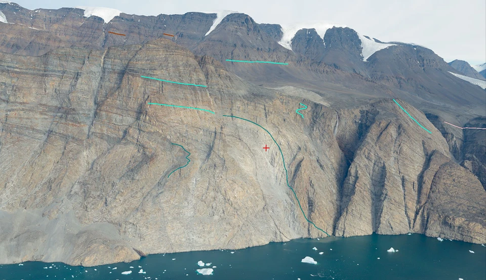
Oblique photo taken from helicopter along Kangilleq Fjord (West Greenland) showing folded and sheared Palaeoproterozoic quartzites.
Pierpaolo Guarnieri
Senior Researcher
Mapping and Mineral Resources