Registered earthquakes in Greenland

GEUS is responsible for recording earthquakes and other tremors in Greenland, both on land and at sea. Measuring equipment is located at strategic locations, which send data to our seismologists around the clock. The results of the measurements can be seen on an interactive map, which is updated continuously once the data has been analysed.

What does the earthquake map show?

The map makes it possible to gain insight into, among other things:

  • where and when the tremors are registered
  • earthquake strength (magnitude)
  • depth of the earthquake
  • seismic activity over time

You can, among other things, filter data by strength, date or year and click on each individual record for detailed information.

Nearly 60 years of seismic data

The earthquake map contains measurements dating back to 1969, i.e. almost 60 years of data. However, there are far fewer measured earthquakes in the past. This is not because there were fewer earthquakes back then, but because measuring equipment and measurement efforts have improved significantly, allowing us to detect far more of the tremors that actually occur.

In addition to providing knowledge about earthquakes in Greenland, GEUS’ data is also used in the international monitoring of earthquakes and nuclear tests and contributes to more accurate localisation.

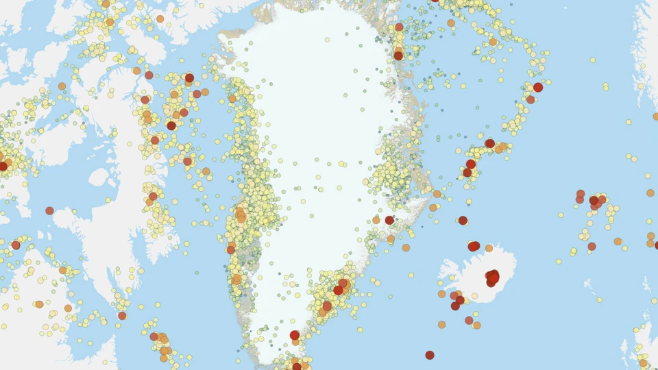
This is how GEUS ensures the quality of data

The portal draws data directly from GEUS’ national earthquake database, where data is continuously quality assured by our team of seismologists. This means, among other things:

  • non-seismic events – such as explosions from the military or other man-made tremors – are removed from the map
  • parameters such as the time, epicentre and magnitude of the earthquake are adjusted as more calculations are made
  • Seismological events in neighboring countries are registered, but not quality assured by GEUS

This process ensures that the map and associated data services reflect the best possible scientific assessment.

Free access to earthquake data

Our earthquake data is freely available in several standardised formats that can be used in your own work.

Available data services include, among others:

  • WMS and WFS for Denmark and Greenland
  • a comprehensive GeoJSON file, that is automatically updated and can be downloaded for further integration into your own GIS systems.

These are accessed via the web portal Registered earthquakes in Greenland.

See also registered Greenland earthquakes in tabular form (in danish).