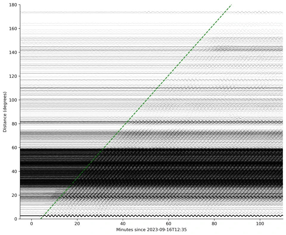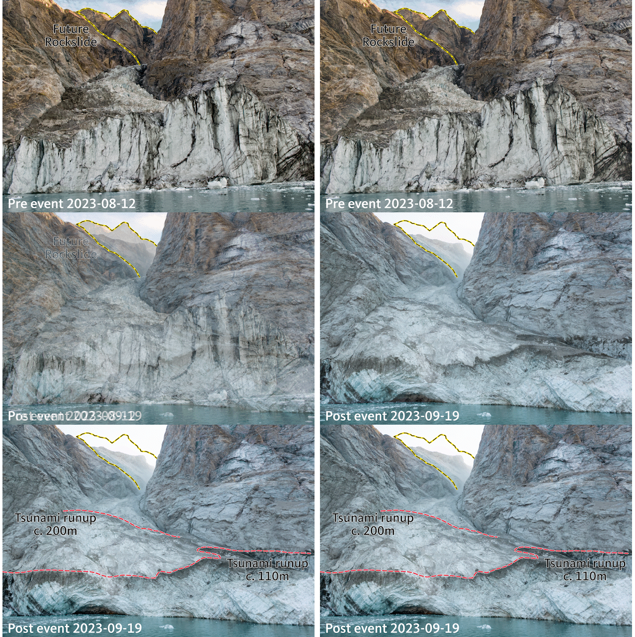
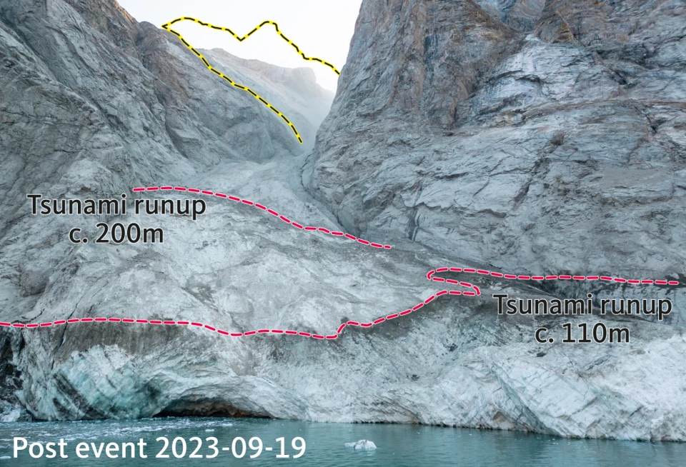
A mysterious seismic signal lasting 9 days was discovered by puzzled seismologists on highly sensitive sensors all over the globe, from the Arctic to Antarctica, in September 2023. The signal looked completely different to frequency-rich earthquake recordings - it contained only a single vibration frequency, like a monotonous-sounding hum. When the study’s authors first discovered the signal, they made a note of it as a USO: Unidentified Seismic Object. At the same time, news of a large tsunami in a remote North East Greenland fjord reached authorities and researchers working in the area. The two teams joined forces in a multidisciplinary group involving a unique collaboration of 68 scientists from 40 institutions in 15 countries, combining seismometer and infrasound data, unique field measurements, on-the-ground and satellite imagery, and simulations of tsunami waves. The team also used imagery captured by the Danish military who sailed into the fjord just days after the event to capture the collapsed mountain-face and glacier front along with the dramatic scars left by the tsunami. It was this unique harmony of local field data and remote, global-scale observations that allowed the team to solve the puzzle and reconstruct the extraordinary cascading sequence of events in September 2023. The results are now published in Science.
“When we set out on this scientific adventure, everybody was puzzled and no one had the faintest idea what caused this signal. All we knew was that it was somehow associated with the landslide. We only managed to solve this enigma through a huge interdisciplinary and international effort,” says lead author, Kristian Svennevig, from the Geological Survey of Denmark and Greenland (GEUS).
Seismometers are sensitive scientific instruments that record vibrations traveling through the ground - called seismic waves. Traditionally, seismology focuses on measuring seismic vibrations arising from earthquakes in the ground. However, seismic records can also contain information about movements of large masses on Earth’s surface, such as landslides and water waves. The study found that the landslide was from the collapse of a mountaintop that previously towered 1.2 km above the fjord. The volume of material that collapsed was massive - more than 25 million cubic metres - enough to fill 10,000 Olympic-sized swimming pools. This collapse was caused by glacial thinning at the base of the mountain over recent decades, ultimately caused by climate change.
"As a landslide scientist, an additional interesting aspect of this study is that this is the first-ever landslide and tsunami observed from eastern Greenland, showing how climate change already has major impacts there,” says Kristian Svennevig.
Numerical simulations, data from local oceanographic sensor network, satellite and on-the-ground imagery confirm that the resulting mega-tsunami is one of the highest seen in recent history. Further out of the fjord, 4 m high tsunami waves damaged a research base at Ella Ø (island) 70 km away and destroyed cultural and archaeological heritage sites across the fjord system. The fjord is on a route commonly used by tourist cruise ships visiting the Greenland fjords. Fortunately, no cruise ships were close to Dickson Fjord on the day of the landslide and tsunami, but if they had been, the consequences of a tsunami wave of that magnitude could have been devastating.
The signal was so puzzling, that one of the scientific team members tried to recreate the long-lived sloshing effect in their bathtub at home. They failed to simulate the same effect, so it was left to detailed mathematical models to show that the landslide direction, together with the uniquely narrow and bendy fjord channel, was the last missing piece of the puzzle of how climate change rang the Earth for 9 days. The predictions showed that water sloshed back and forth every 90 seconds, the same oscillation period observed in the seismic waves. This perfect match shows how the force of the moving water body, generating a distinct oscillation due to the width and depth of the fjord, creates seismic energy in the crust.
The study concludes that with rapidly accelerating climate change, it will become more important than ever to characterise and monitor regions previously considered stable and provide early warning of these massive landslide and tsunami events.