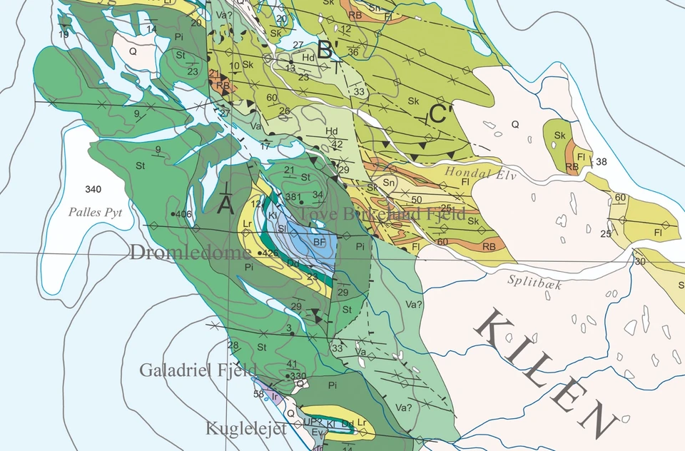

The Kilen map area is located on Kronprins Christian Land, eastern North Greenland, where a thick succession of Carboniferous–Cretaceous sedimentary rocks of the Wandel Sea Basin is exposed.
A substantial part of the map data was obtained by geological photogrammetry from helicopter using hand-held cameras combined with fieldwork focussing on the complex stratigraphy of the area.