Photo by Frederik Wolff / Underground Channel.
Follow our scientific expedition on board HDMS Lauge Koch. Expedition ICAROS – Ice-ocean interactions and marine ecosystem dynamics in Northwest Greenland - took place between 22 Aug - 3 Sep 2021. A team of 12 scientists from GEUS, DMI, AU, and GINR performed measurements and collected samples along the Northwest Greenland coast with the goal to obtain a better understanding of how sea ice, glaciers, and ocean conditions are changing in this area, and how they impact the marine ecosystems. This blog reports on Leg 1 of a 3 weeks-long expedition. Due to operational challenges faced by the Royal Danish Navy, it was not possible to complete our planned work in the region of Thule/Qaanaaq (leg 2).
The 17th of September 2021
Navigating icy waters
Fieldwork in the high Arctic is not without its risks. Meet cruise leader Sofia Ribeiro on board the ICAROS 2021 expedition as she outlines the expedition objectives, and the challenges of doing multidisciplinary science while navigating icy waters. Watch the video by Frederik Wolff / Underground Channel.
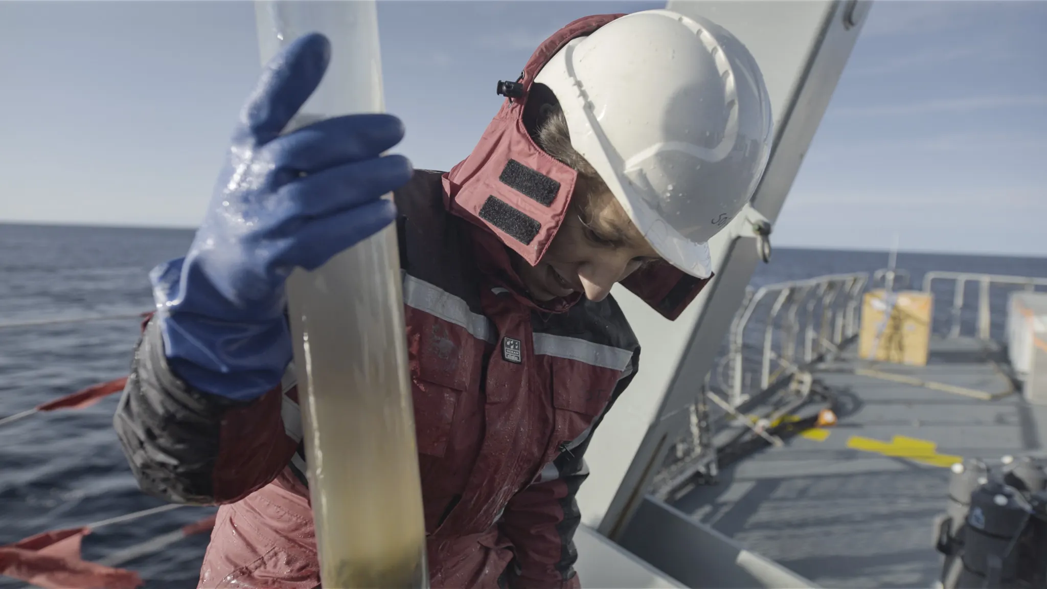
The 14th of September 2021
The gravity Corer
Meet scientist Christof Pearce onboard the ICAROS21 cruise in NW Greenland as he takes us through the sampling process with the gravity corer and how the seabed can inform us about our past climate. Watch the video by Frederik Wolff / Underground Channel.
The 31st of August 2021
Measuring the Oceanic features in Melville bay
Meet Steffen Malskær Olsen from DMI onboard the icaros21 cruise to the Northwater. A key instrument to understand the oceanographic fluxes in North Greenland is the CTD instrument which measures the salinity, temperature and depth in high resolution. Watch the video by Frederik Wolff / Underground Channel.
The 31st of August 2021
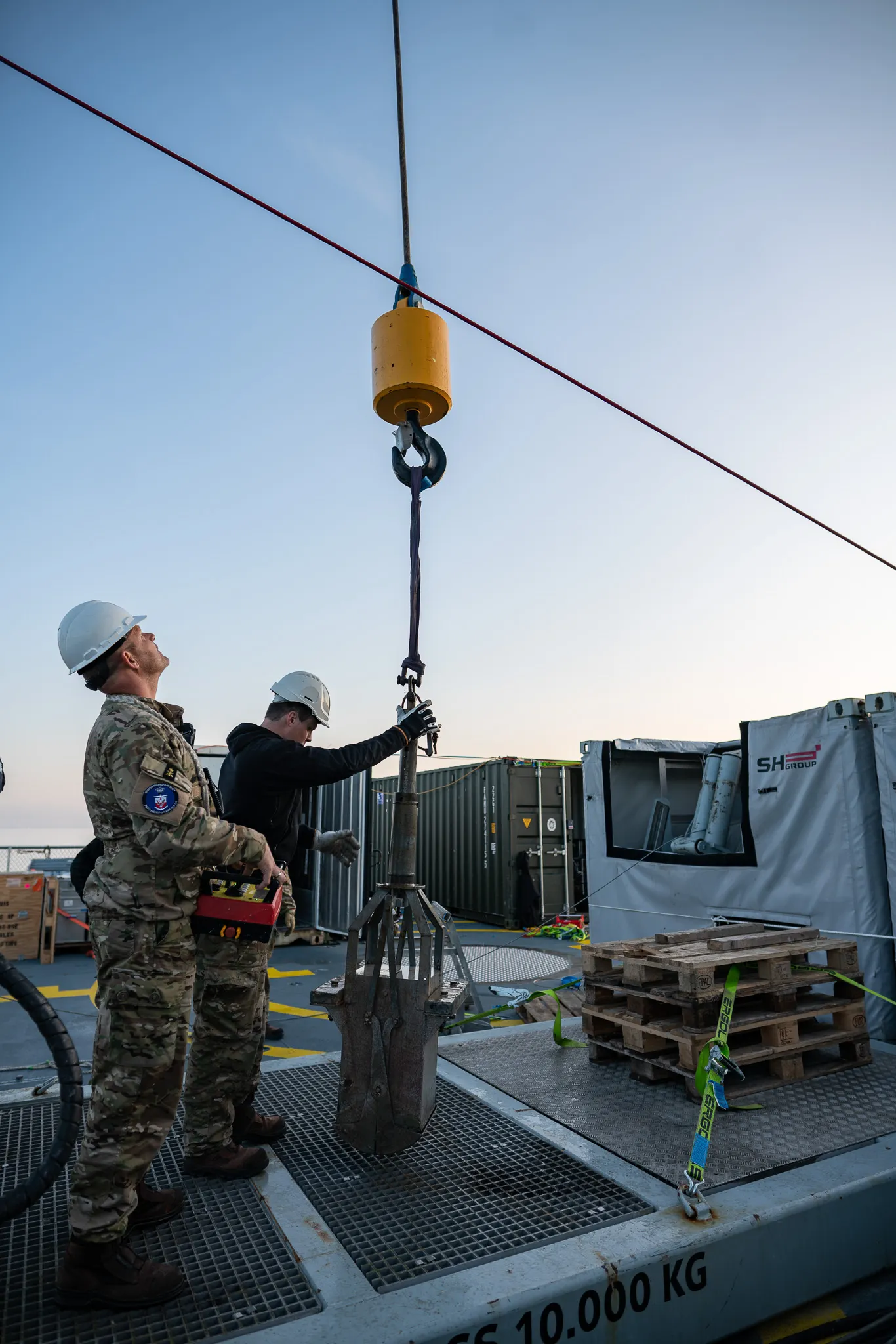
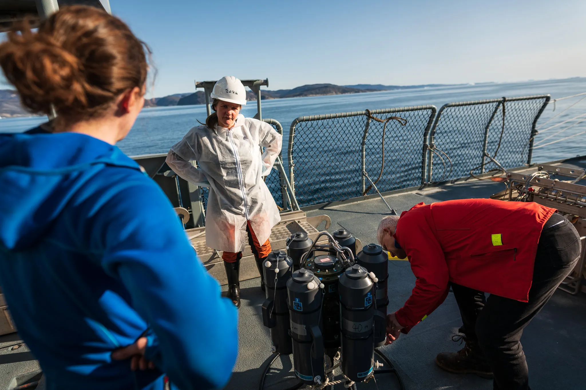
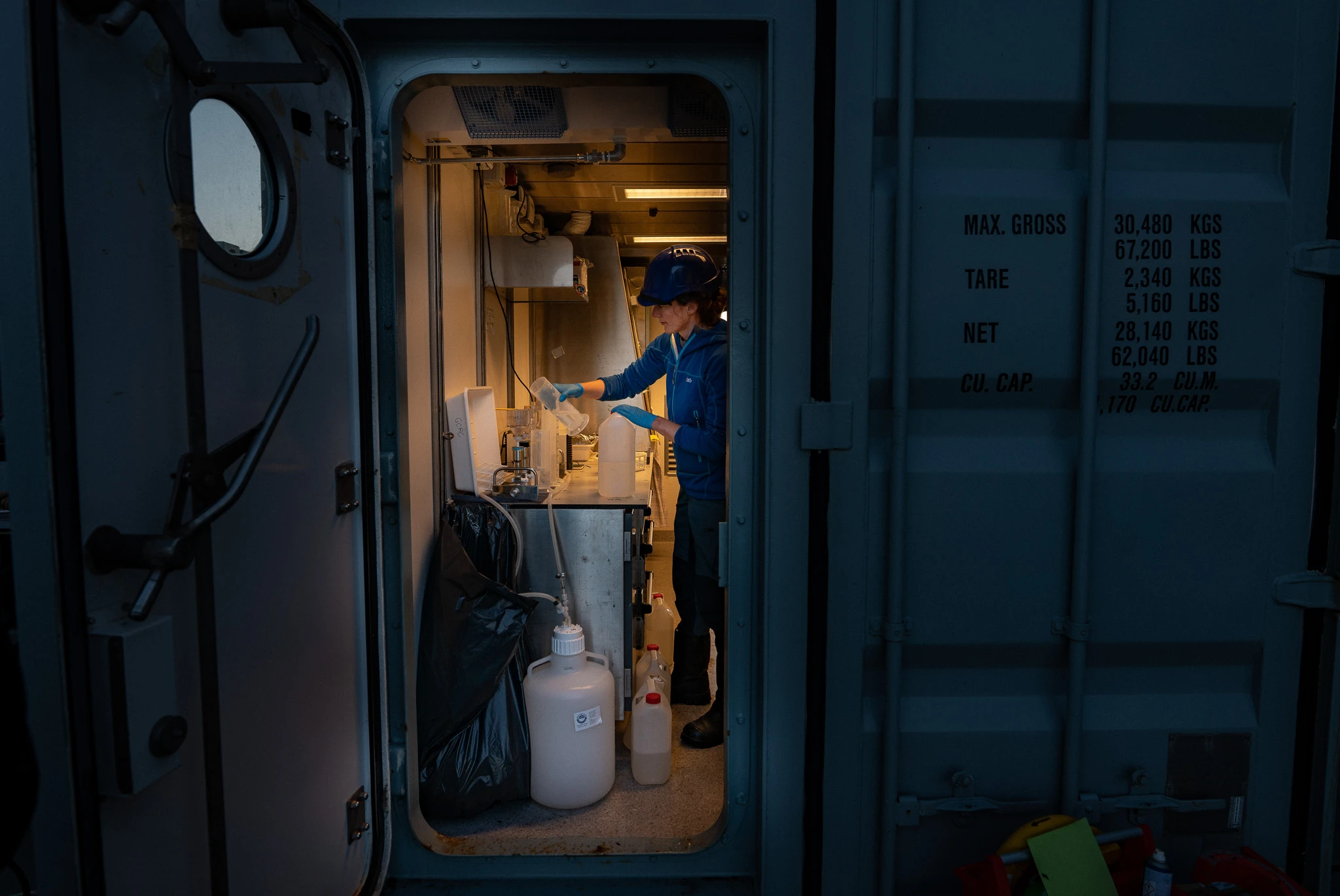
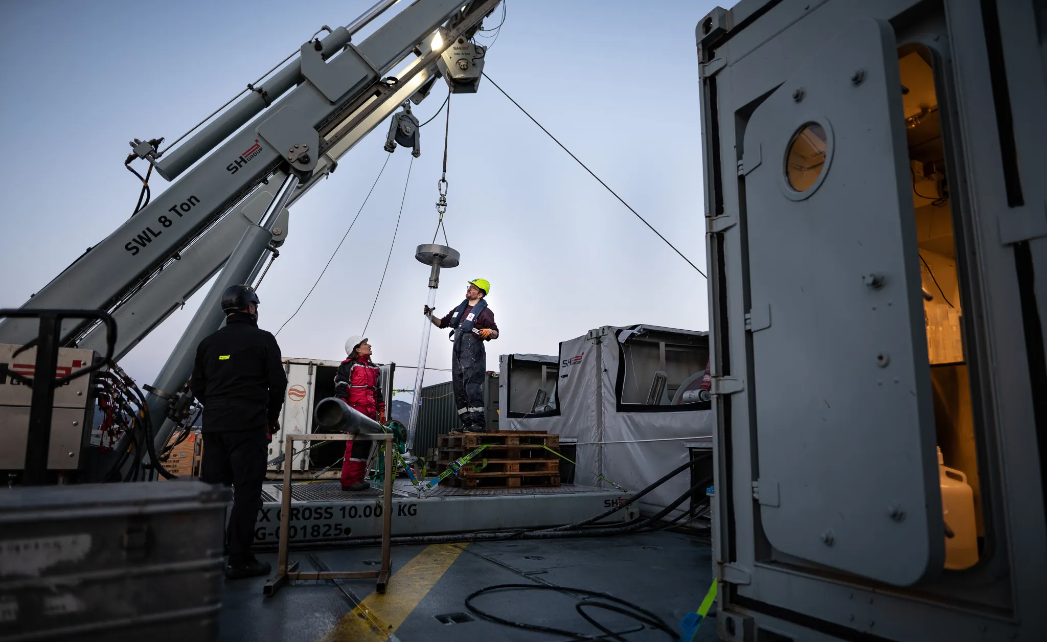
Photos from the expedition, (day 4 to 7)


Photos by Frederik Wolff / Underground Channel.
The 30th of August 2021
Nighty night from the geophysics survey room
Here at Lauge Koch it is not only about sediment and water!
We also do geophysical surveying using two hull-mounted acoustic instruments - a multibeam echosounder to scan the seafloor and a sub-bottom profiler to image the sediments below the seafloor. I typically get the ship during the nights where I do surveying in order to find suitable coring sites with at least 3-4 meters of soft sediment (the mud!) - so that we can get some nice gravity cores. I sit in the geophysics survey room where I monitor the data from the two instruments and ensure that we get the data recorded.
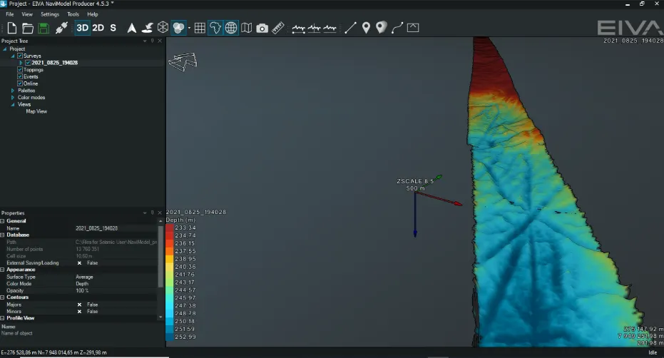
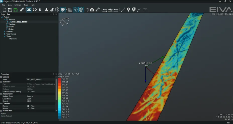
Besides finding the good muddy spots for my colleagues, I also use the data to investigate the morphology of the seafloor. The morphology can tell me about the geological processes at the seafloor – for instance where erosion or deposition takes place and whether it is pelagic sedimentation or redeposition due to down-slope processes (e.g. forming turbidites) or bottom currents (e.g. forming sediment waves or contourites). In some areas, I can also see morphologies created by the ice – for instance scouring by icebergs, so-called ploughmarks which in places form a messy criss-crossed seafloor! Quite spectacular to look at and amazing to imagine the forces that the ice induces on the seafloor.
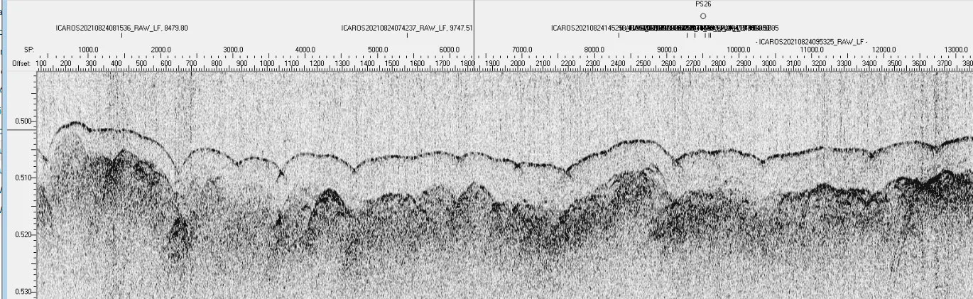
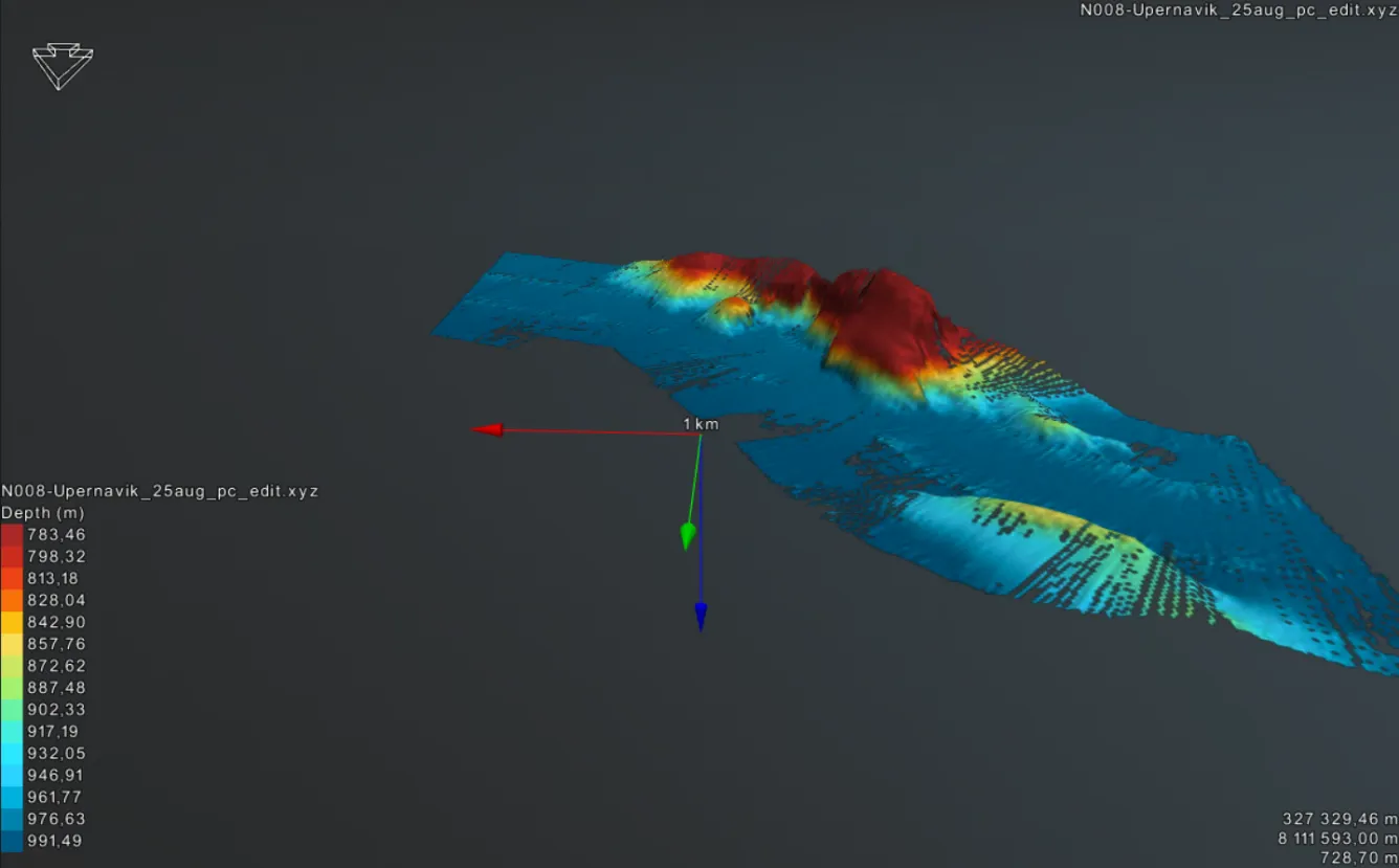
Using the multibeam echosounder together with the sub-bottom profiler further allows me to look back in time and see how the geological processes have changed. This is really interesting to explore in a place like NW Greenland where the ice-dynamic and Holocene processes are still not fully understood.
I’ll get back to the screens - sleep tight!
By geophysicist Katrine Juul Andresen
Photos by Frederik Wolff / Underground Channel.
The 27nd of August 2021
Mapping the seafloor
Watch the ICAROS21 cruise to the Northwater in NW greenland by Frederik Wolff / Underground Channel. In this video you meet scientist Katrine Juul Andresen from Aarhus onboard. She maps the seafloor in 3D to locate suitable coring stations.
The 22nd of August 2021
Impressions from the first days of the LAKO 2021 cruise ICAROS
On a cold and misty morning in Aasiaat, we gathered our gear and headed down to board the HDMS Lauge Koch and meet the crew. The ship slowly appeared through the dense fog that had settled over the harbor during night, and we were welcomed on board by the kind Quartermaster Erik.
First things first. Before anything else when you board a ship in harbor, you need to move your personal pin from “off ship” to “on ship” on landgangs-tavlen. This is an absolute must do so the crew knows whether you are on board or in harbor. Having done that, prepping could begin while we moved to our first station at Rødebay, a little north of Ilulissat.
Perfect conditions at the first station
Arriving at the first station, the weather had turned in to a beautiful sunny and calm day. Perfect conditions for us to run the first full station with CTD, Rosette water sampler, HAPS, Rumohr lot and Gravity Corer. Minor technical issues occurred but that always seems to be the case on these cruises, and for the very same reason, we had also picked this station as our “test station”. Thereby any unexpected issues could be fixed before the next station was reached.
The entire night we cruised pass the Disko island through the Vaigat towards our second station at Uummaanaaq. Here we sampled for both water and sediments at water depths down to 600 meters, targeting sediment samples covering the entire Holocene epoch. The crew on board LAKO is wonderful to work with. There is always a possibility of a helping hand on deck, and we feel very welcome and in good hands.
Preparing for stormy weather
Now we are steaming towards our third station in the Upernavik area (south on the shelf) approaching Upernavik tomorrow on way to Upernavik fjord, where we will do a transect, sheltered from the upcoming stormy weather.
We will see how the weather behaves and after that continue our journey to Melville bay.
Photos by Frederik Wolff / Underground Channel.

About the expedition
Our marine research expedition is a collaborative effort between GEUS, DMI, AU, and GINR focusing on Northwest Greenland. This area is strongly affected by the Arctic amplification of global warming. The region hosts some of the most productive coastal marine ecosystems in the Arctic that sustain keystone species and Inuit livelihoods. The research program combines state-of-the-art oceanographic, biogeochemical, and paleoclimate research with emerging ancient DNA methods to bring new insights into the modes of climate change and Holocene variability. The cruise objectives include tracking the components of the West Greenland Current system including the upper, fresher waters from glacier melting and runoff and the offshore and deeper, warmer branch of subpolar origin from Upernavik across the Melville Bay and further north. The critical interactions with glaciers and coastal ecosystems will be studied in detail in the fjord systems of Upernavik and Inglefield Bredning.
Read more
Cruise Participants

Sofia Ribeiro
Position: Senior Researcher - GEUS
Role: Cruise leader; Paleoceanography, Climate proxies, (Paleo)ecology
Steffen Olsen
Position: Research Leader - DMI
Role: Cruise co-leader; Modern Oceanography, CTD
Andreas Muenchow
Position: Professor, U Delaware,
Role: Ocenography, ice-ocean interactions
Christof Pearce
Position: Assistant Professor, Aarhus University,
Role: Sediment coring, Paleoceanography
Katrine Juul Andresen
Position: Assistant Professor, Aarhus University,
Role: Sediment coring, Sub-bottom profiling
Sara Harðardóttir
Position: Postdoc - GEUS
Role: Plankton, eDNA and Paleogenetics
Heike Zimmermann
Position: Postdoc, GEUS,
Role: Paleogenetics, Paleoecology
Alice Stuart-Lee
Position: PhD Student, GINR/NIOZ,
Role: Ice-ocean interactions, Ecosystem dynamics.
Anna Bang Kvorning
Position: PhD Student, GEUS,
Role: Paleoceanography
Vilius Tolsgaard,
Position: MSc student, Aarhus University
Role: Paleoceanography
Frederik Wolff
Position: Underground Channel,
Role: Filmmaker
Eik Brischt
Position: DTU,
Role: DCH-certified Technican
Supporting fundings
- Dansk Center for Havforskning
- DFF-Sapere Aude Group Leader Grant
- Marie Curie Global Fellowship
- Nationalt Center for Klimaforskning at DMI
![]()

![]()
